I had imagined that Mt Sukai would be just be a heavily forested hiked and I’d be beating my way through the bushes. I was mostly right but there were some small scrambles to balance it out.
I started the hike early in the morning at 5:30am after driving there for a bit over an hour from my hotel. From the car park, it’s about an hour’s walk up a closed but mostly paved road to the start of the trail head.
There’s quite a bit of these kinds of road, where at some point whoever was maintaining the road decided it was not worth it anymore and it just gets closed. Looking at the tracks on the ground, it seemed like someone might have rode a bike to close the distance.

Two hours in, I reached the Koshin mountain hut (庚申山荘). Like the road I passed, it has now fallen out of disrepair and no longer operated. It looked a little spooky, even under the bright morning sun. When I passed by again later on the way down with an overcast sky, it gave off creepy vibes. The toilet nearby is still open though. Here, I took a short break to fuel up.

The route that I took today is apparently what is known as a “classic route”, which means that it was once used by the people of yore. It also usually means a longer and more difficult route compared to the newer routes that have been opened up since that. However, in this case, this route to Mt Sukai, crossing over a few other peaks with numerous ups and downs, is the only route available today. A shorter, 5 hour approach was closed in 2020 from what I read.
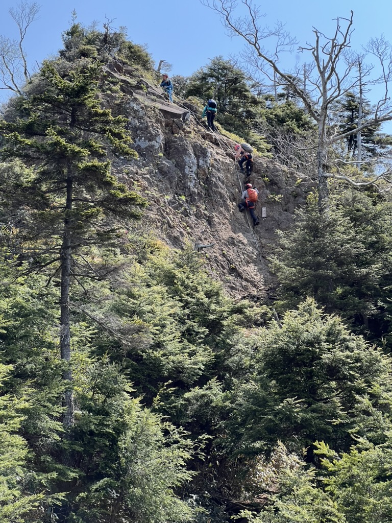
The path up until had a very gradual incline. But from the hut onwards, the path started getting rough. Between Yakushidake (薬師岳) and Nokogiriyama (鋸山), there are number of scrambles. For me, this was the best part of the hike. It had been almost half a year ago since I last did any scrambling and I was happy to get back into it. I feel so much more involved being able to use my entire body instead of just my legs. It brought to mind how long winter had been.
Once Nokogiriyama has been passed, the trail returns to mostly normal walking. There is quite a bit of descent between Nokogiriyama and the peak of Mt Sukai but I was able to push on quickly knowing that I was almost the peak.

The peak doesn’t have too much of a view. I took the obligatory picture of the sign showing the name and altitude of the peak, had a quick snack and started back down. It has been about 5 hours since I started, and there was about the same amount of time needed to go back down.
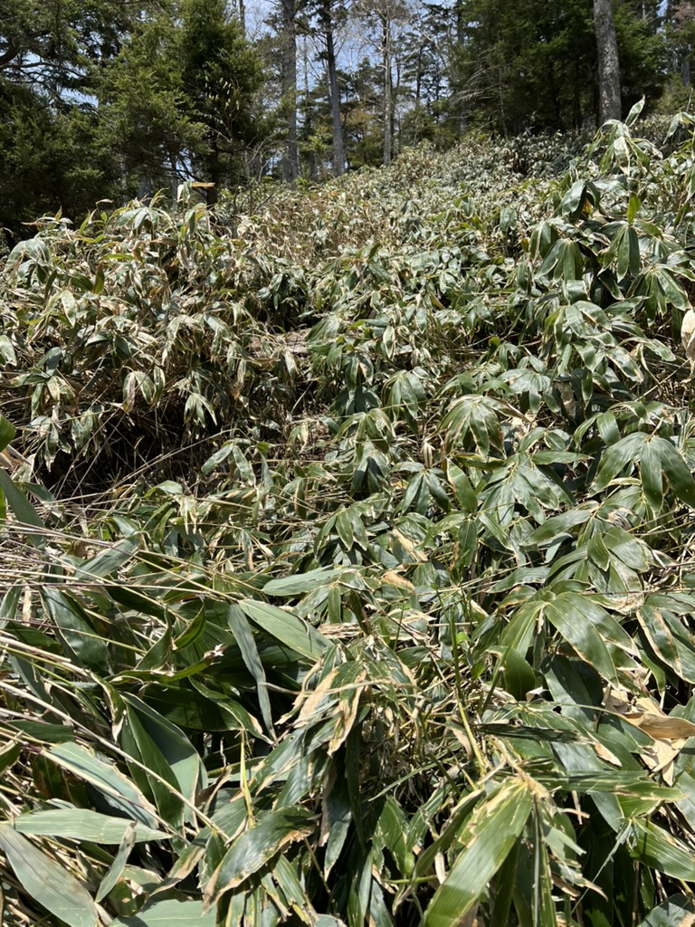
The course I took is a circular route that loops around back down, avoiding some of the peaks I had crossed. The return back wasn’t technical, but it was way more frustrating. Most of the return route is covered by overgrown sasa, a kind of low growing bamboo. In many areas it reached up past my waist. This was bushwalking in the very literal sense of the word. I lost the trail many times. Either the route seemingly disappeared or that there were multiple routes, some probably made by animals that I was confused which to take. It felt like forever.
Eventually I got through sasa hell and back on a much gentler path. At this point I felt pretty bored and was happy to finally reach the car park.
Getting there
Date hiked: 2025/06/02
Stayed the night before at Hotel R9 The Yard 桐生. From there it is an hour drive to Ginzandaira Parking Lot (銀山平駐車場). Dropped by Mizunuma Onsen on the way back.
YAMAP track: https://yamap.com/activities/40457938
